Omnitracs Navigation v4.3 Release Notes
Introduction
This document describes the new features and enhancements for Omnitracs Navigation. These changes are implemented in Omnitracs Navigation version 4.3 scheduled for fall 2016.
For previous releases click here.
New Features and Enhancements
Map Editor
Omnitracs Navigation 4.3 now provides users access to the Map Editor. The Map Editor lets you make changes to the streets and roads used by Omnitracs Navigation so that the map data accurately reflects the roads you want to use. For example, there may be roads that your vehicles cannot use, so you do not want Omnitracs Navigation to direct your drivers to use those roads. You can mark these roads disabled in the Map Editor and they will not be used. You can also edit roads according to various attributes such as weight, clearance, or posted speed limit or you can mark roads as commercially restricted. The Omnitracs Navigation application will check for map edits every time it is started and every four hours after starting, so that drivers have the most up to date street information when getting directions.
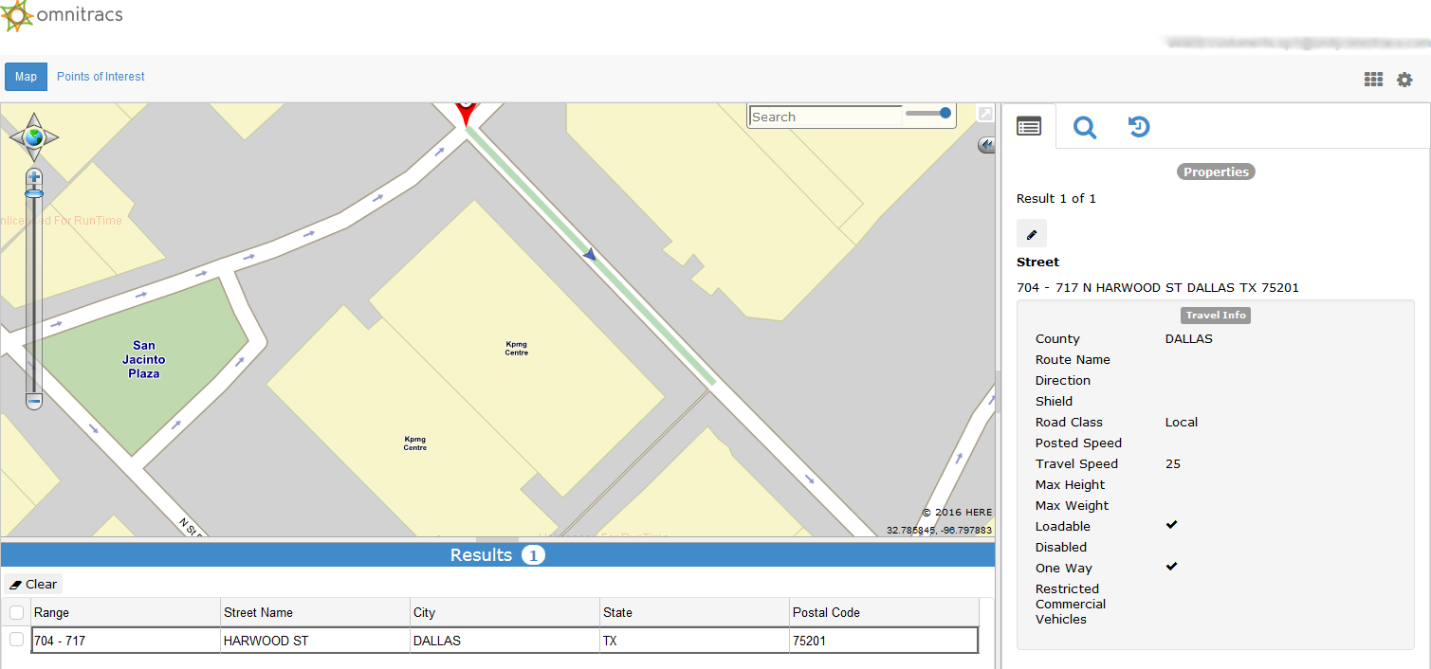
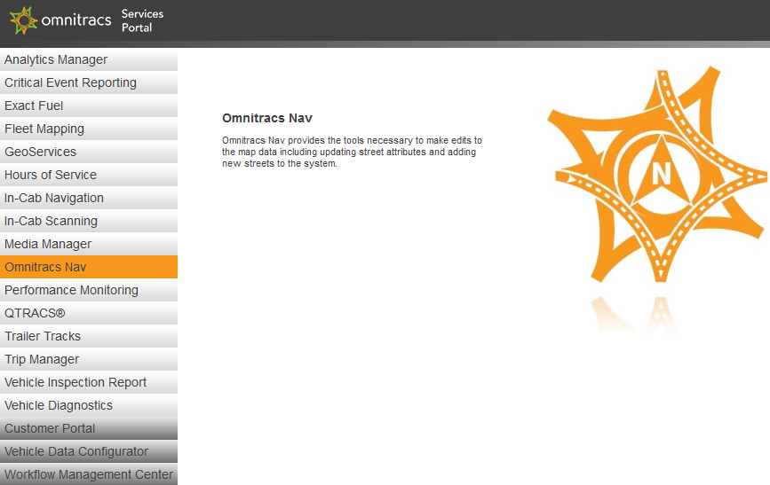
The Map Editor is part of the Omnitracs Navigation portal, which can be accessed from the Services Portal or Customer Portal. Detailed instructions on how to use the Map Editor can be accessed from the Map Editor’s help menu by clicking the gear icon in the upper right of the Map Editor screen.
Updated Map Data Set
In order to take advantage of all the performance improvements in Omnitracs Navigation 4.3 such as improved routing and panning and a quicker response from the app you must also have the v11 map data set released concurrently with Omnitracs Navigation 4.3.
Once updated to Omnitracs Navigation 4.3, users can utilize the new over-the-air map data download feature to update to the v11 map data set if their mobile units have Wi-Fi capabilities. For units without Wi-Fi, map data can be updated via USB, which can be downloaded from the Customer Portal or ordered through your Customer Experience Representative.
To check your current map data set, tap Settings then tap About. The About screen will display the current version of Omnitracs Navigation installed on the mobile unit as well as the current map data set.
Minor Enhancements and Bug Fixes
- Fixed an issue where editing an invalid dispatch address was not clearing the invalid address notification.
- Fixed an issue where interstate names were sometimes being displayed as the local road or route name instead of the interstate name.
- Fixed an issue where routing could freeze or return a route to a destination 0 feet away when routing to streets associated with multiple cities.
- Fixed an issue where routing did not always work for some existing addresses.
- Fixed an issue where cardinal directions could not be included when searching for street names such as N Main Street.
Known Issues
- Form entry feedback fields are sometimes incorrectly populated with old or incorrect data when using the back button.
- Text to speech directions for upcoming maneuvers may sometimes be delayed and not provide adequate time to execute an upcoming maneuver such as warning a driver to get into the left lane because a left turn is coming up. This only applies to the spoken directions and not the turn by turn directions displayed on the mobile unit.
- When reordering stops on a trip, sometimes it is not possible to move a stop up on the list and it can only be moved down.
- Selecting the Skip Next Stop option during a trip cancels the trip.
- Using the +Add to Trip option adds the new destination to the beginning of the trip list instead of the end.
- The Auto option for units is not working. Either Metric or Imperial needs to be manually selected to switch units of measurement.
- Choosing map view when editing a destination in a trip shows the user's current location instead of the destination location.
- If a driver changes the date and or time of an issue in the driver feedback section but backs out without sending the feedback, when the issue is viewed later the fields to change the date and or time retain the previous changes that were not sent.
- Whenever a route takes an exit off of a tollway, it does not list the name of the exit or exit number.
- Destinations cannot be added to a trip from the Favorites menu.
- Text to speech can sometimes cut off in the middle of announcing a maneuver and the entire text to speech system will stay off for several minutes before resuming functionality.
- Routes through Atlanta are incorrectly using I-75, I-20, and I-85, which are prohibited instead of using I-285 to go around Atlanta.
- When a highway transitions from one name to another, the change is not announced by the text to speech.
- The application sometimes freezes for about 30 seconds while the vehicle is moving.
- Successive rerouting of long routes can cause the IVG to freeze.
- The application sometimes interprets vehicles as being on service or access roads instead of on the highway, which can cause speed alerts to improperly trigger if being used. This normally occurs when the application routes the vehicle to take an exit but the vehicle skips the exit and stays on the highway.
- The application sometimes incorrectly route drivers into HOV lanes.
- Address ranges with a hyphen cannot be searched for if it is not listed in the address range.
Previous Releases
- Omnitracs Navigation 5.1 Release Notes
- Omnitracs Navigation 4.9 Release Notes
- Omnitracs Navigation v4.4 Release Notes
- Omnitracs Navigation v4.3 Release Notes
- Omnitracs Navigation v1.6 Release Notes
© 2019 Omnitracs, LLC. All rights reserved.
Omnitracs is a trademark of Omnitracs, LLC. All other trademarks are the property of their respective owners.
Omnitracs endeavors to ensure that the information in this document is correct and fairly stated, but Omnitracs is not liable for any errors or omissions. Published information may not be up to date, and it is important to confirm current status with Omnitracs. Specifications subject to change without notice.
This technical data may be subject to U.S. and international export, re-export or transfer (export) laws. Diversion contrary to U.S. and international law is strictly prohibited.